Introduction
In recent years, the integration of technology into public safety has seen tremendous growth, particularly in how road information is communicated to the public. One of the most significant advancements is the addition of real-time road closure feeds by public safety agencies, which are now compatible with navigation applications. This article delves into the implications of this development, its history, and what the future holds for public safety and road management.
Historical Context
The evolution of public safety agencies and their approach to traffic management has been a remarkable journey. Historically, road closures due to construction, accidents, or extreme weather were communicated through signs and radio announcements. However, with the advent of smartphones and GPS technology, these traditional methods have become outdated. The modern commuter demands timely and accurate information about road conditions, leading to the integration of real-time data into navigation systems.
Early Days of Navigation Apps
Navigation applications such as Google Maps and Waze revolutionized the way people interact with roadways. Initially, these apps provided users with basic navigation routes and estimated travel times. However, as user-generated data became prevalent, these platforms began to incorporate real-time traffic conditions, including slowdowns and detours.
Transition to Real-Time Data Feeds
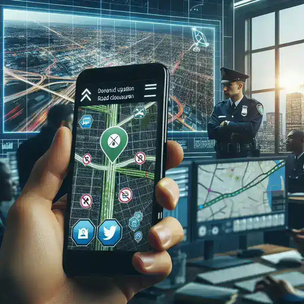
Recognizing the need for real-time updates, public safety agencies began collaborating with tech companies to provide accurate road closure feeds. This transition marked a significant shift in traffic management strategies, where data-driven decisions are paramount. Public safety agencies harnessed technology to not only inform drivers about closed roads but also to predict potential traffic buildups, enhancing overall road safety.
How Real-Time Road Closure Feeds Work
Real-time road closure feeds operate through a network of sensors, cameras, and data-sharing protocols. Public safety agencies collect data on road conditions, accidents, and closures, which is then transmitted to navigation apps almost instantaneously. Here’s how the process unfolds:
- Data Collection: Public safety agencies gather data from multiple sources, including traffic cameras, sensors embedded in the road, and reports from law enforcement.
- Data Processing: The collected data is analyzed to determine the status of roads—whether they are open, closed, or experiencing heavy traffic.
- Transmission to Apps: Once processed, the information is sent to navigation apps that update their maps in real-time.
- User Alerts: Drivers using navigation apps receive immediate alerts about closures, enabling them to reroute and avoid traffic jams.
Benefits of Real-Time Road Closure Feeds
The integration of real-time road closure feeds into navigation apps provides numerous benefits:
1. Enhanced Safety
By informing drivers about road closures, these feeds help reduce accidents caused by unexpected detours or road obstructions. This proactive approach ensures that drivers can make informed decisions on their routes.
2. Improved Traffic Flow
With real-time updates, drivers can avoid congested routes, thereby improving the overall flow of traffic. This is particularly important during peak hours when road closures can exacerbate delays.
3. Increased Efficiency
By utilizing navigation apps equipped with real-time data, commuters can save time and fuel, leading to a more efficient travel experience. This is especially beneficial for those commuting to work or running errands.
4. Community Engagement
Public safety agencies can engage with the community more effectively. By providing real-time information, they establish a trust relationship with the public, showcasing their commitment to safety and transparency.
Challenges and Considerations
While the integration of real-time road closure feeds offers numerous advantages, it is not without challenges:
1. Technology Dependence
The effectiveness of these feeds relies heavily on technology. Areas with poor internet connectivity may not receive timely updates, potentially compromising safety.
2. Data Accuracy
For these systems to be effective, the data provided must be accurate and timely. False or outdated information can lead to confusion and traffic issues.
3. Privacy Concerns
The collection of data raises privacy concerns for some individuals. Public safety agencies must navigate these concerns carefully, ensuring that data collection is conducted responsibly.
Future Predictions
The future of real-time road closure feeds looks promising as technology continues to advance. Here are some anticipated developments:
1. Enhanced Integration with Smart Cities
As cities become smarter, the integration of real-time data into city infrastructure will improve. This means that road closure feeds could be linked not only to navigation apps but also to traffic signals and public transportation systems.
2. Machine Learning and AI
The use of machine learning and artificial intelligence will enhance data analysis. This could lead to predictive models that anticipate traffic disruptions before they happen, allowing for proactive measures to be taken.
3. Wider Adoption of IoT Devices
The Internet of Things (IoT) devices will play a critical role in the future of road safety. By enabling better data collection and communication, IoT devices can revolutionize how road closures are managed.
Conclusion
Public safety agencies adding real-time road closure feeds compatible with navigation apps represents a significant stride towards safer and more efficient road management. By leveraging technology, these agencies enhance public safety and improve the commuting experience for drivers. As we look to the future, ongoing advancements in technology promise to further refine the accuracy and effectiveness of these systems, ultimately leading to smarter, safer roads for everyone.